Rhodes Pond
Finally back at full pool!!! the winter rains have finally filled and ran over the dam on December the 19th 2023 ~5 months after the gates were Closed
**Note - You can enlarge the pictures by clicking on them, **
This Blog Post will give a history on Rhodes Pond and I will provide old pictures and videos and pictures of the pond drained and pictures and videos of the pond after being filled again. I will also post what you can catch and see in this awesome Pond.
By studying the pictures when dry and the aeriel photos you can tell where the hot spots are going to be, example the water along the dam meaning there is a ditch/gut running just above the dam and the same can be see along the dike.
Rhodes Pond is a 700 acre Lake on the Black River in Cumberland County NC. This Lake started off as Smith's Mill Pond in the 1700's and was part of John Smiths Plantation. Back then the Dam was merely pegged logs. I could not find a date when the Wood Dam was taken out and the Concrete dam installed. From ~1920 -1964 the ownership had changed and it was known as Hollands Pond. Then in 1964 Jerry S. Honneycutt purchased the property and it became known as Rhodes Pond Fish Camp. This is the man I used to pay and fished it back in the 90's .
Unfortunately in November of 2000 Mr Honeycutt Passed and then in December of 2004 The State of North Carolina purchased the property from the Honeycutt family.
Then disaster struck in 2013 as Hurricaine Andrea eroded one side of the dam. The state got funding to repair the dam and while it was being repaired in 2016 Hurricaine Matthew struck with 15 inches of rain in the Black River Basin and the dam/repairs breached again. The repairs done were to the soils and breaches on each side of the dam but after Matthew the State decided to replace the cement dam as well and put better soils on each side of it.
**one postive about it being Dry for so many years as there are numerous Cypress trees growing in the lake bed and a lot of those are going to survive when the lake is full**
FEMA and the State got funding to redo the whole Dam but it almost didnt happen as the cost was extremely high and other issues but funding was finally approved and dam work started in August of 2022 and was completed in April of 2023. The Dams 2 gates (seen below) would not be closed until inspectors gave their thumbs up to the project. Sometime in the summer on 2023 the inspectors gave their approval and the gates were closed in early August of 2023.
Post Card From/about Rhodes Pond Back in the Day.
Here are some pictures of the lake and aerial photos before the breaches.
**You can click on the picures to make them bigger***
This is an aeriel photo and you can see the lake is actually divided in 2 by a long strip(dike) of trees running from the dam up river. there is one opening in it to get boats through (red circle) , the dam is in the yellow circle and the ramp is at the X.
These are pictures of the dam after the first Breach and in the process of being repaired in late 2013 or early 2014
Now for picture(s) of the dam after Hurricaine Matthew in 2016
Here are some aerial photos during construction taken sometime between August 2022 to April 2023
Here you can see the concrete dam done in V patterns vs just straight accross
This Picture is on the North side upstream side of the dam. The 2 openings in red will always provide a minimun flow to the Black River when the water is not flowing over the top.
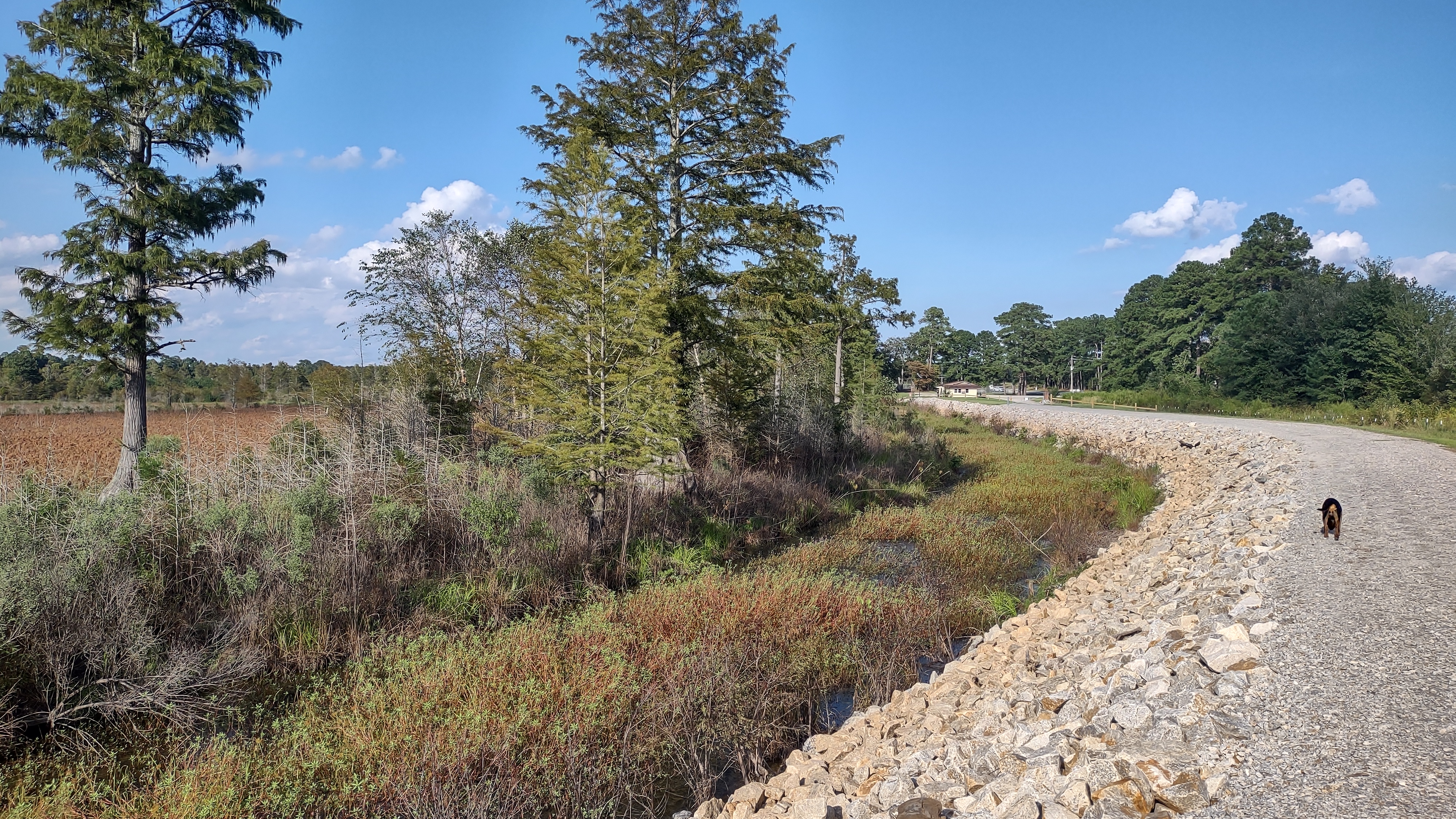
This picture is on the very south end of the earthen part of the dam where there is a creek/ditch that can help drain water out of the lake into the black river during high flows. The water will only run into this drain when the lake level is 6 inches higher than the spill way.
Here is a Zoomed in shot showing Cypress trees on the South (left) side of the Dike. You can see the Bald Cyprees trees scattered and growing along the river channel
Here is another shot of the North Side of the dike and you can see a ditch that runs in the bottom of the lake.
Here are a few aerial shots from early Spring 2023 with a little water in Rhodes.
Here are some Photos taken April The 15th 2023 before work has been completed. Dam is finished but the mounds of dirt behind it have to be removed and then waiting on inspectors to inspect everything. The water is high due to spring rains but the 2 gates are open so lake cannot fill and go over the top.
The earth mounds above the dam will be removed after the water goes down.
In these Pictures you can see the 2 gates.
Dike that seperates the 2 sides
Dike looking up and right
Dike looking back towards ramp.
~1/2 way between ramp and dam looking towards dam
Looking towards Ramp
Standing near ramp looking left
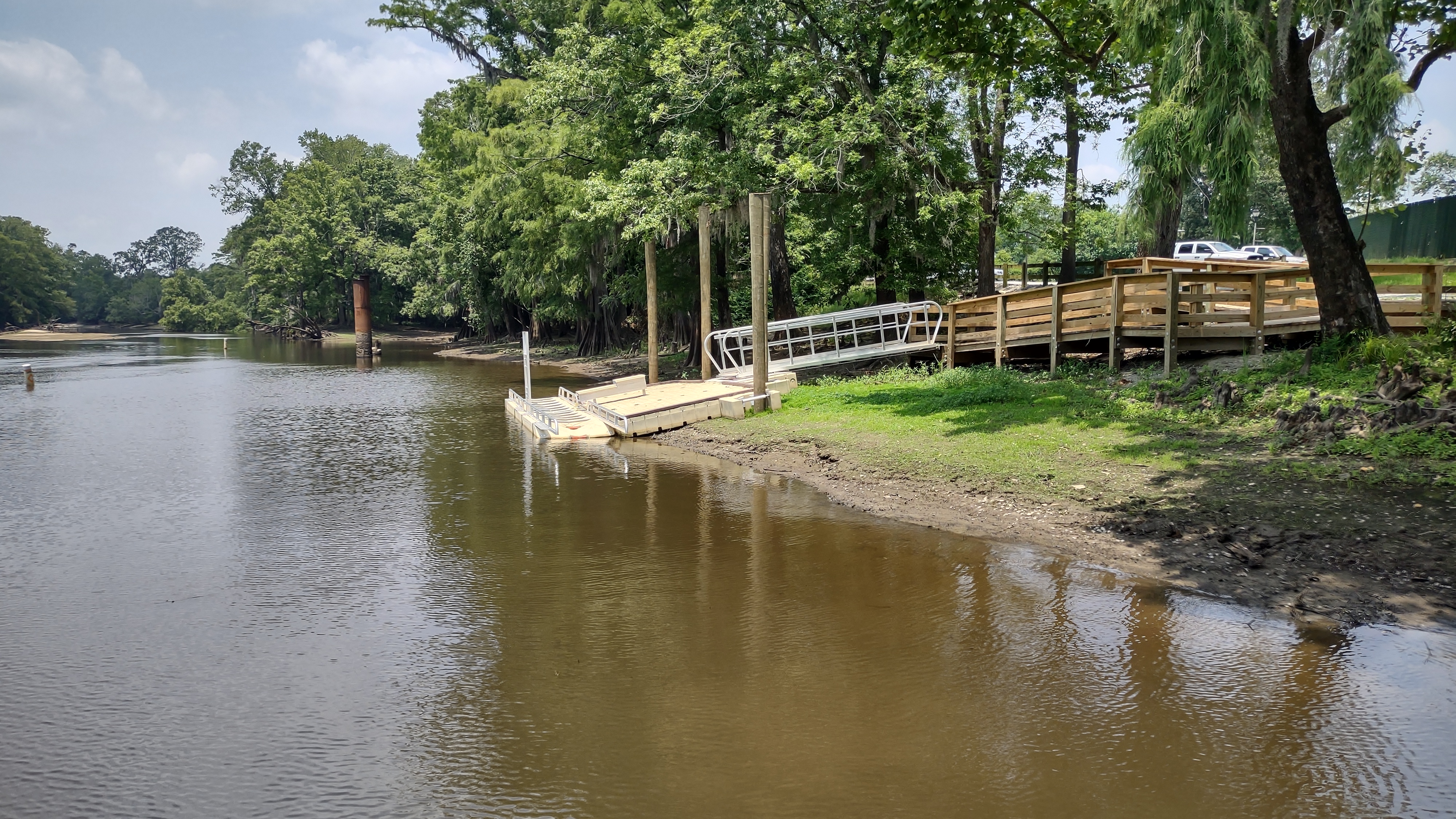
Ramp- Dock not installed yet
Looking straight out from ramp
Late August after Dam gates were closed( Gates were closed on August 9th 2023 except for a very small minimun downstream flow has to be kept)This picture is on the south side of the dam 2 weeks after the gates were closed(late August 2023) The lake is ~5 foot below overflowing the dam. . You can see the dirt mounds from contruction are gone
Pictures from 092423 Just after a Tropical Storm - Note it still needs 5-7 feet of water to be full.
Pad where new Floating Pier/Deck will be attached to
I drove to the south side of the dam and took these Pictures.
Thanksgiving Day 2023. There has been a really bad drought this fall so that is why the lake is not full. It may take to late winter to fill completely.
Dike looking upstream at the cut through
Cut through looking left and up
Looking left and slightly down
Cut Through looking towards Boat ramp
At Ramp Pointing towards cut through in Dike
On ramp looking towards Cut through. (Zoomed in) Cut is between Cypress in middle and the cypress to the left. You can see the old deck if you look closely.
Below Pics taken December 29th 2023 10 days after Pond has filled! Yeah it is at Full pool !
These were taken standing on the ramp
These were taken standing where the pier will be, looking at the ramp then looking left
These were taken at the bend in the dam...looking towards the ramp then left finally looking towards dam
These were taken between bend in earth dam and spillway looking towards ramp then left finally looking towards spillway
...Spillways shot
Start of Dike running up into lake
Standing on Dike 800 feet up from spill way at the cutthrough in th dike looking towards ramp then at second part of dike then left
******Added - 01/14/24 A few days ago The Pier was added and it is in the shape of a
"T" . The floating dock was also installed beside the ramp. I will add pics of these this spring.
******more pictures, videos and updates coming soon***
************They will be added right here********
#rhodespond
#blackriver


.jpg)


